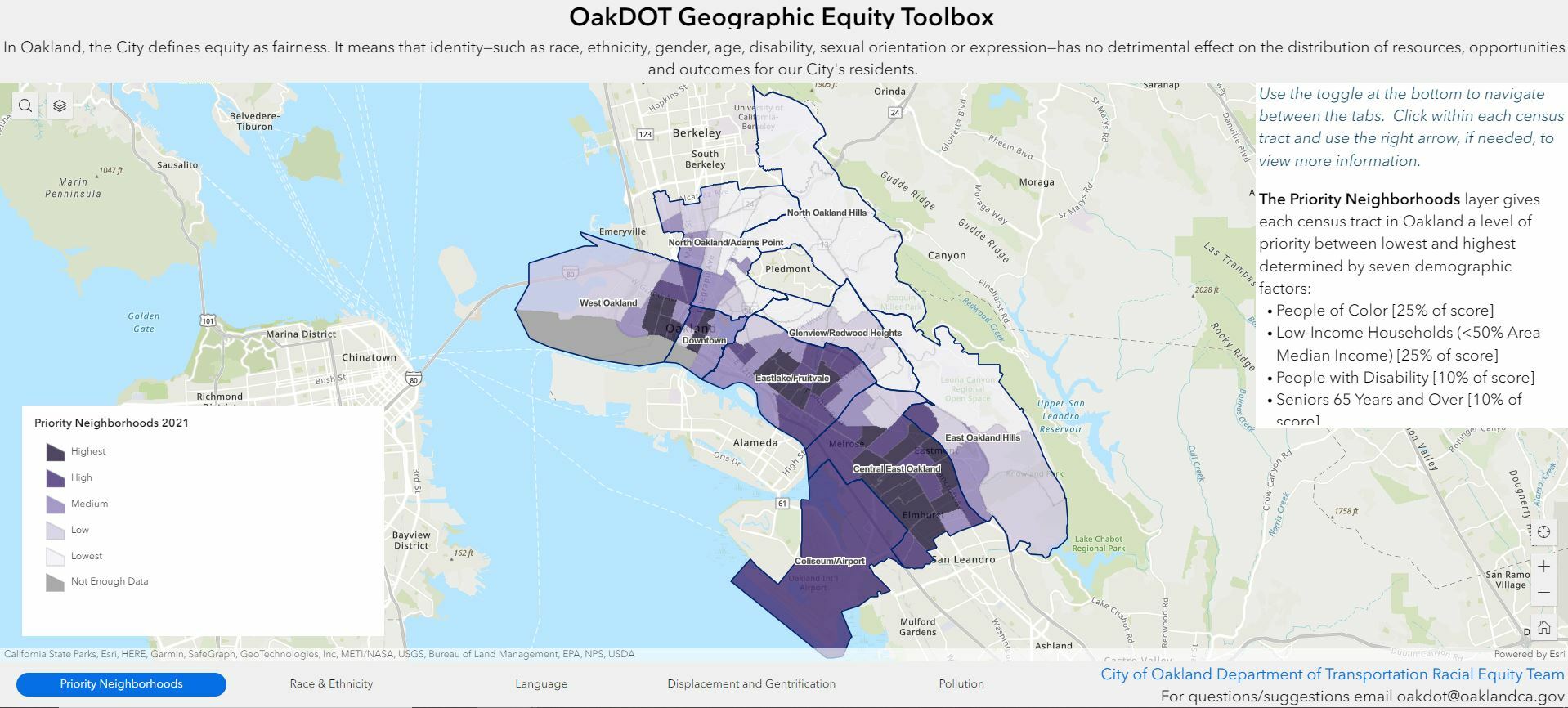
Oakland Department of Transportation (OakDOT) Geographic Equity Toolbox was created as a way for the City of Oakland to prioritize neighborhoods based on concentrations of people with demographic factors determined to have experienced historic and current disparities.
The goal of the OakDOT Geographic Equity Toolbox is to inform our work and guide our investments to advance DOT’s Racial Equity Goals and Citywide efforts. Recognizing that not everyone has the same needs, this tool is meant to leverage attention and funding to neighborhoods that may have been historically and currently overlooked by city services and planning processes. This tool is not meant to replace community outreach, but rather provide a data-driven context for how disparities play out spatially across Oakland. Priority neighborhoods should receive more in-depth community outreach in order to consider the specific needs of populations of people with demographic factors determined to have experienced historic and current disparities.
The OakDOT Geographic Equity Toolbox has four tabs, each of which add information to provide a data-driven context for how disparities play out spatially in Oakland. OakDOT staff are encouraged to use these tabs to make data-informed decisions about where to prioritize policies, programs, projects, and funding.
